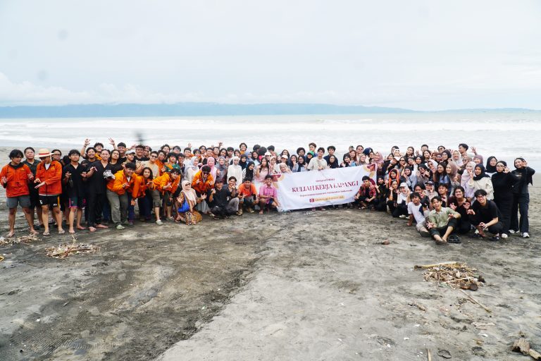
A total of 124 students from the Geography Study Program, Faculty of Mathematics and Natural Sciences, Universitas Indonesia (FMIPA UI), conducted a Field Work Lecture (KKL) in Simpenan District, Sukabumi Regency, from October 26 to 31, 2025. This annual activity, in addition to being part of the curriculum, also serves as a form of community service that has been carried out since the early 2000s. This year, the students mapped administrative boundaries, compiled village profiles, and verified satellite imagery-based thematic maps in six villages: Kertajaya, Cihaur, Loji, Cidadap, Cibuntu, and Mekarasih.
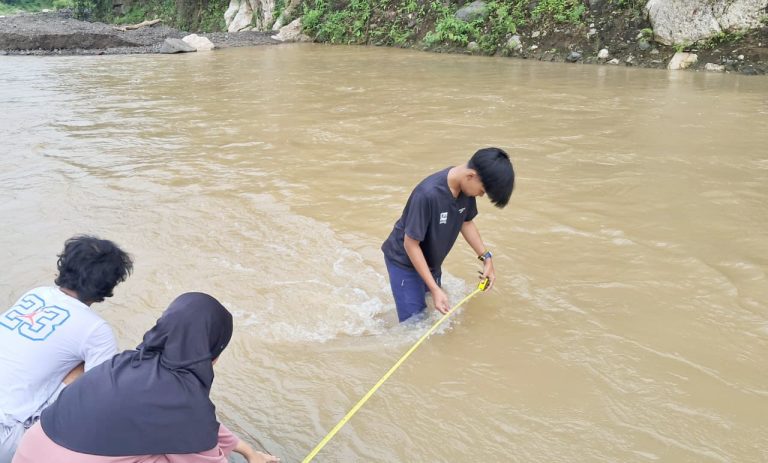
Over six days, the students conducted land-use map verification, streamflow and water quality measurements, participatory mapping, and resident interviews to update spatial and social data. The activities were supervised by six lecturers and three teaching assistants, including Dra. Astrid Damayanti, M.Si (coordinator), Kuswantoro, S.Si, M.Sc, Riza Putera,
According to Dra. Astrid Damayanti, M.Si, this activity was designed to help students understand the application of geographical theories in the field.
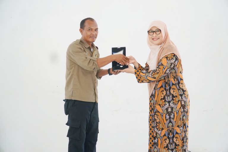
“Students not only learn how to map an area but also directly interact with the community and understand spatial dynamics in a real context. The field data collected will be handed over to the village government as an academic contribution,” she said.
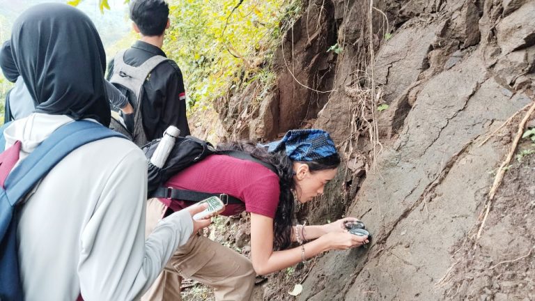
Each student group was responsible for mapping one village with a different theme, such as geology, geomorphology, hydrology, soil type, land use, and human activities. Before going to the field, the students prepared thematic working maps using GIS software based on high-resolution satellite imagery.
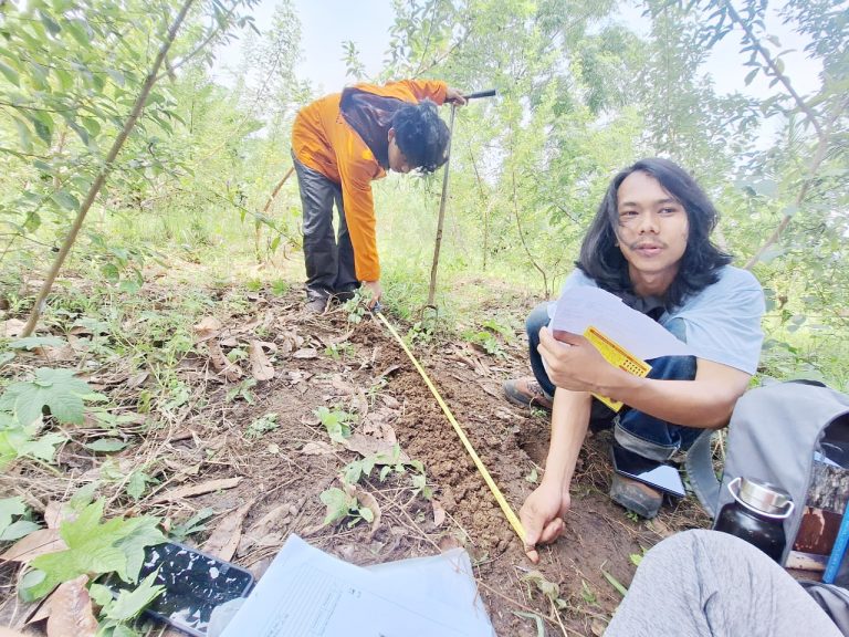
For instance, Cibuntu Village covers an area of 1,963 hectares, consisting of four hamlets and 4,625 residents, the majority of whom are farmers, with strong potential in agriculture and plantations. The students identified 22 sediment rock sampling points and five waterfalls, which serve as material for analyzing the village’s natural resource and geotourism potential.
This year’s Field Work Lecture (KKL) faced several geographical challenges and the impacts of landslides, with some hamlets in Mekarasih and Cibuntu Villages becoming isolated. In addition, water discharge measurements were hindered by wide rivers with multiple tributaries. Apart from agriculture, Kertajaya and Cihaur Villages also have mining activities—both legal and illegal (artisanal mining)—which were further analyzed to assess their impacts on spatial planning and the environment.
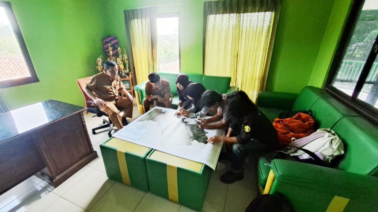
The participatory boundary mapping carried out with local communities helped clarify spatial structures at the village level and assisted local governments in developing more targeted planning. Field data on agricultural potential and disaster risk can also be used to analyze regional vulnerability to climate change, which directly affects community food security.
The outcomes of the Field Work Lecture (KKL)—including digital and printed maps, village reports, and the Village Potential Book of Simpenan District—are expected to support data-driven and sustainability-oriented development policies.
“For the past two decades, Sukabumi Regency and City have served as a real-life laboratory for Geography students of FMIPA UI, connecting scientific knowledge with community needs,” added Dra. Astrid Damayanti, M.Si., who served as the coordinator of this year’s program.
In the future, this program will expand to other villages in Sukabumi as part of the Department of Geography FMIPA UI’s commitment to the Tridarma of Higher Education, through academic collaboration that directly contributes to regional development.