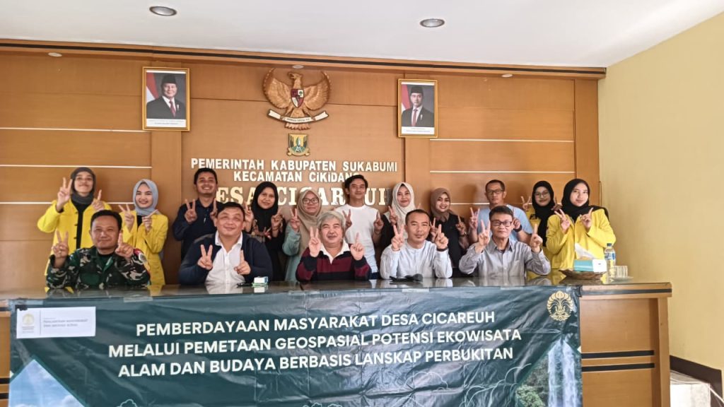
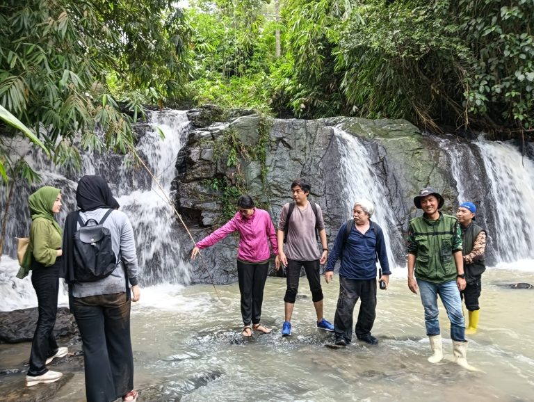
Rolling green hills, the gentle sound of waterfalls, and traces of local culture form the everyday landscape of Cicareuh Village, Cikidang District, Sukabumi Regency. This natural and cultural potential is now being systematically mapped through the guidance of the Faculty of Mathematics and Natural Sciences (FMIPA), Universitas Indonesia (UI) as part of a Community Service program. The initiative is led by the Department of Geography with funding support from a competitive grant scheme provided by the Directorate of Community Service and Social Innovation (DPIS) UI.
From July to December 2025, the UI Community Service team, led by Dr. Tjiong Giok Pin, S.Si., M.Si., a lecturer from the Department of Geography, FMIPA UI, worked closely with the residents of Cicareuh Village to develop nature- and culture-based ecotourism using geospatial mapping. The program goes beyond simply mapping the area—it also fosters community awareness of their village’s potential through an applied scientific approach.
The activity involved cross-faculty collaboration, including Dr. Fuad Gani, S.S., M.A., from the Faculty of Cultural Sciences (FIB) UI. Several undergraduate Geography students from FMIPA UI, Ira Maya Puspita and Raisya Khoiri S.A., as well as FIB UI Master’s alumni Abi Rafdi Ramadhan, M.Hum., also participated as team members. This collaboration exemplifies the UI Community Service team’s contribution in applying geographical knowledge and spatial technology to support data-driven community development.
A total of 40 participants took part in the activity, including village officials, PKK members, Karang Taruna youth groups, farmer groups, and enthusiastic local residents. Their presence made the learning process more dynamic and participatory, where the community not only received information but also played an active role in mapping tourism potential and engaging in discussions on village development.
Until now, the natural potential of Cicareuh Village has not been optimally managed. Limited mapping of tourist areas, minimal use of geospatial technology, and low digital literacy have been the main challenges. To address this, the UI Community Service team introduced satellite imagery-based mapping and Digital Elevation Model (DEM) as a foundation for more sustainable ecotourism planning.
“A data-driven approach combined with community participation is key. Through geospatial mapping, the community can gain a comprehensive understanding of their village’s potential and plan its management with clear direction,” said Dr. Tjiong Giok Pin.
In addition to mapping, community capacity building was also a main focus. The activities began with a briefing session on the ecotourism potential of the hilly landscape presented by Dr. Tjiong Giok Pin. Meanwhile, Dr. Fuad Gani, S.S., M.A., highlighted the importance of AI-based digital literacy to support the promotion and management of village tourism.
“Digital literacy enables village communities not only to be objects of tourism but also to manage the narrative, identity, and promotion of their own village,” explained Dr. Fuad.
The training materials were complemented by community leadership strengthening led by Prof. Dr. Roy Darmawan, SE., M.Si., a professor at the School of Strategic and Global Studies (SKSG) UI, who encouraged the growth of collaboration and collective work in developing the village tourism initiatives.
The series of activities then continued with a Focus Group Discussion (FGD) involving all participants, including village officials, PKK members, Karang Taruna, and farmer groups. The discussion was dynamic and resulted in the agreement to establish a Tourism Awareness Group (POKDARWIS) as the driving force for village tourism management. Bitung Hamlet was designated as the initial site for ecotourism development due to its outstanding natural potential.
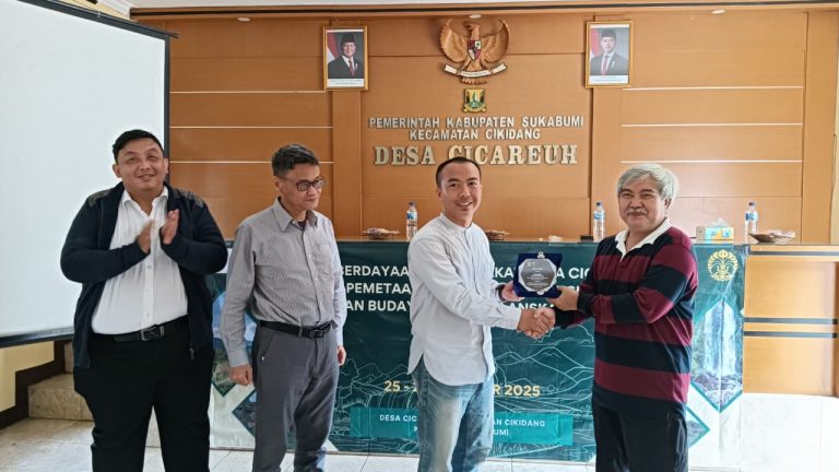
The Head of Cicareuh Village, Ramdan Rustarmono, S.Pd., warmly welcomed the guidance provided by the UI Community Service team. He emphasized the village’s commitment to placing the community as the main actors in tourism development.
“We want the community to be directly involved and self-reliant. With guidance from the UI Community Service team, we are optimistic that the natural and cultural potential of Cicareuh Village can be managed sustainably,” he said.
At every stage of the activities, the team also emphasized the application of the 3K principles—Cleanliness, Beauty, and Sustainability—so that tourism development not only generates economic impact but also preserves the environment and local culture.
Going forward, the program aims to produce evidence-based ecotourism potential maps, prototype tourism trails, and digital promotional media that can serve as the foundation for community-based ecotourism development. This initiative also supports the achievement of Sustainable Development Goal (SDG) 8, particularly the promotion of sustainable tourism that drives economic growth while preserving local culture.
Through the collaboration between the UI Community Service team, the village government, and actively involved residents, Cicareuh Village is expected to develop into a geospatial data-based ecotourism village—a tangible example of how scientific knowledge can be applied to create direct, meaningful impact on community development.