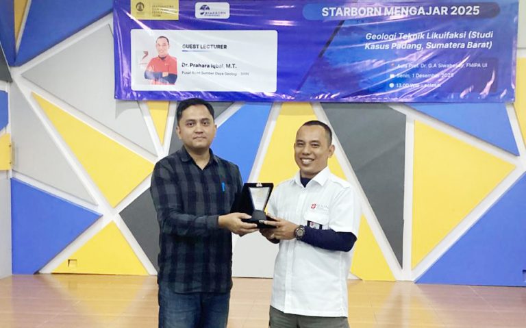
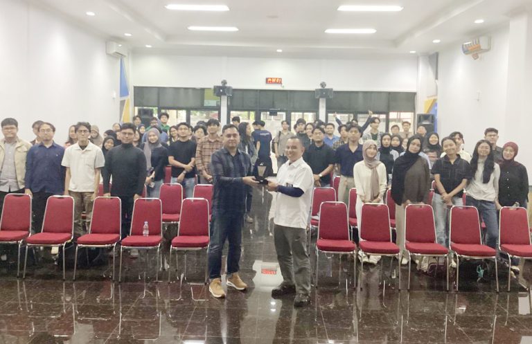
Providing students with the opportunity to learn directly from experienced practitioners is an important effort to broaden their perspectives and to help them understand the real-world application of geoscience. To support this, the Faculty of Mathematics and Natural Sciences at Universitas Indonesia (FMIPA UI) held the weekly UI Geoscience Seminar X STARBORN MENGAJAR 2025 on Monday (1/12) at the Prof. Dr. G.A. Siwabessy Auditorium, UI Campus, Depok.
This week’s seminar carried the theme “Engineering Geology of Liquefaction (Case Study: Padang, West Sumatra)” and featured Dr. Prahara Iqbal, M.T. from the Geological Resources Research Center – National Research and Innovation Agency (BRIN) as the speaker. The event was attended by around 80 students from the Geology and Geophysics study programs.
In his presentation, Dr. Prahara explained that engineering geology studies how soil and rock conditions affect the safety and sustainability of infrastructure. “Factors such as morphology, lithology, geological structures, and groundwater conditions greatly determine soil stability in disaster-prone areas,” he said.
The seminar highlighted the phenomenon of liquefaction, which is the loss of soil strength caused by earthquake shaking in water-saturated sand layers. Padang City was chosen as the case study because it has the characteristics of coastal alluvial deposits, shallow groundwater levels, and strong shaking intensity from the Sumatra subduction zone. According to Dr. Prahara, “The combination of these factors makes Padang City highly vulnerable to liquefaction, and this must be taken into account in spatial planning and infrastructure development.”
Participants were also introduced to field indicators of liquefaction such as sand boils, ground cracks, and surface deformation, as well as geotechnical analysis methods used to assess vulnerability. Dr. Prahara emphasized, “By recognizing field indicators and conducting geotechnical analysis, we can map risk zones and take appropriate mitigation measures before a disaster occurs.”
The Q&A session was interactive. Students enthusiastically asked about the soil parameters that most influence liquefaction and how geospatial data can be used for risk modeling. “Geospatial data has now become an important tool in anticipating disasters, allowing development planning to be safer and more sustainable,” said Dr. Prahara.
The seminar concluded with the presentation of a plaque to the speaker and a group photo session with all participants. This activity reaffirms FMIPA UI’s commitment to enhancing students’ understanding of geological phenomena that have a direct impact on public safety and spatial planning.