The FMIPA UI Community Service Team, chaired by Dr. Rokhmatuloh, M.Eng., is currently carrying out community service activities in Kalibaru Village, North Jakarta.
This activity will be carried out over a period of 8 months, starting in June and ending in November.
During this period, Rokhmatuloh and the team attempted to complete the activity with the theme of Utilization of Geographic Information System (GIS) & Remote Sensing (PJ) Technology Using Participatory Methods for the Preparation of Detailed Thematic Maps in Kalibaru Village, Cilincing District, North Jakarta.
The main partners involved in this activity are the Kalibaru Village dasawisma officers.
“This community service program aims to strengthen the function and role of dasawisma through spatial data presentation,” Rokhmat told the FMIPA UI public relations team.
According to him, the recap of data collection from dasawisma officers, whether done manually or application-based, has so far only been presented in the form of tabular statistical data or graphical info.
Thus, through this program, Rokhmatuloh and his team trained the dasawisma officers to be able to utilize the role of information systems that are oriented towards references on the earth’s surface or spatially, as a basis for decision-making for planning and operationalization.
Dasawisma officers are the smallest organ of the Family Welfare Empowerment (PKK) which has the formal task of collecting detailed data on the conditions of the community per housing unit.
Rokhmatuloh, who currently serves as Deputy Dean II of FMIPA UI, explained that one dasawisma officer oversees ten residential units.
The workshop kicked off the program. Held in the Kalibaru Village Hall (July 10th), representatives from the neighborhood association (RW) dasawisma officers, village staff, and the PKK (Family Welfare Movement) community service team participated in a simulation of how dasawisma officers could utilize remote sensing data (drone photos).
The result is that the dasawisma officers are able to create a map of RT boundaries and the distribution of dasawisma in Kalibaru Subdistrict.
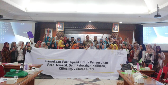
Monday (5/8) still at the same location, the team held participatory mapping training to compile detailed thematic maps as a continuation of the workshop activities.
This training involved 50 participants consisting of dasawisma officers, RW representatives, PKK administrators and village staff.
Based on tabular data collected by village officials, participants are trained to have skills in simple spatial data processing.
The output of this stage is that partners can obtain information on environmental conditions spatially from maps that have been produced using Geospatial Information Systems (GIS) Technology.
GIS application created using QGIS softwareopen sourcewhich is designed in such a way that it is easy to operate by the user.
Participants will be given one month from the training event to participate in inputting data on incidents/conditions in their respective areas of responsibility. The updated results will then be disseminated at a second workshop in September.
In addition, there are several other series of activities that will take place until November, including participatory mapping, data processing assistance, and ending with a seminar on the results of the activities.
To ensure the program’s sustainability, the team has engaged the sub-district head, Suyono, from the outset. He has provided significant support by assigning sub-district staff to act as operators for map updates.
In the future, the community service program by FMIPA UI will end by providing optimal, sustainable benefits and increasing environmental insight for residents in general, especially for dasawisma officers.