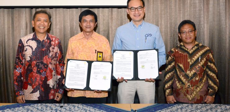
The Faculty of Mathematics and Natural Sciences (FMIPA) of the University of Indonesia (UI) received a grant for ArcGIS software from PT ESRI Indonesia related to geospatial science. This collaboration aims to support national development by utilizing all geospatial technology resources owned by FMIPA UI and ESRI Indonesia.
This agreement was signed by Dr. rer. nat. Abdul Haris, Dean of FMIPA UI, and Dr. Achmad Istamar, CEO of Esri Indonesia, on Wednesday (10/10) at the Apung Room, University of Indonesia, Depok, as part of the 10th G-Days event.th.
This collaboration is based on the awareness and desire of both parties to create harmonious synergy between the private sector/industry and universities in implementing the Tri Dharma Perguruan Tinggi (Three Pillars of Higher Education).
Haris stated that this collaboration emphasizes human resource development, community service, and scientific research to provide solutions to existing societal problems.
Dr. Supriatna M.T. The Head of the Geography Department, Faculty of Mathematics and Natural Sciences, University of Indonesia (FMIPA UI), explained that ArcGIS software is very beneficial for the development of mapmaking in the geospatial field. Furthermore, Supriatna stated that this software can be used in Urban Planning Management, Regional Planning and Permitting, Disaster Management, Infrastructure Development Planning, and Regional Resource and Potential Management.
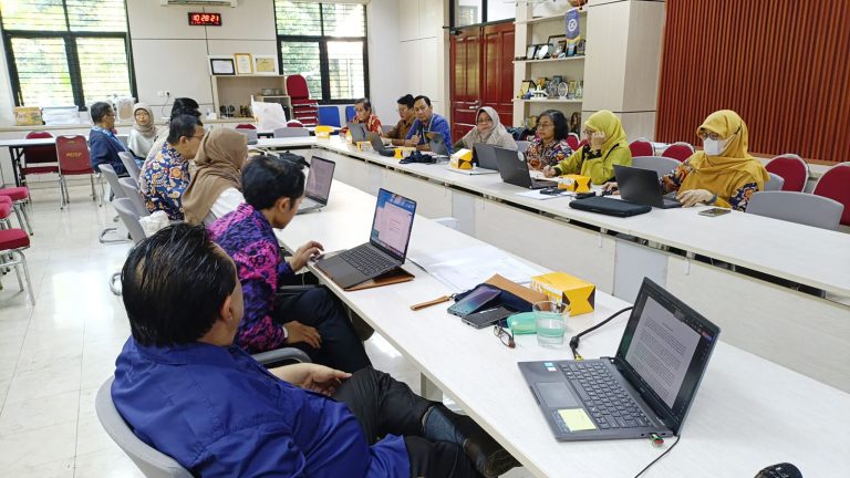
The software will also be used free of charge by the UI academic community, including students, lecturers, teaching assistants, and researchers within the UI environment, for research activities and the completion of final assignments, including theses, and dissertations.
To obtain a license for this ESRI-developed software, Supriatna continued, UI academics can submit an application to the Geographic Information System (GIS) Laboratory Coordinator of the FMIPA UI Geography Department by filling out an application form.
Through this collaboration, PT ESRI Indonesia also provides facilities for undergraduate, master’s, and doctoral students to intern at PT ESRI Indonesia.
PT ESRI Indonesia will also support maintenance and upgrades on the software. ArcGIS Platform in accordance with the existing license period, namely 2 years, in addition to providing Esri Newsletter, ArcNews bulletin and ArcUser in the form of Hardcopy or Softcopy.
A Brief Explanation and Uses of ArcGIS
ArcGIS is software developed by ESRI (Environment Science & Research Institute). It is a compilation of functions from various GIS software, including desktop GIS, server GIS, and web-based GIS. This software was first released by ESRI in 2000.
ESRI (Environmental Systems Research Institute), headquartered in Redlands, California, is one of the established companies in GIS software development. Debuting with ArcInfo 2.0 in the early 1990s, ESRI has continuously improved its products to accommodate various needs in natural resource and environmental management.