The Faculty of Mathematics and Natural Sciences, University of Indonesia (FMIPA UI) is committed to improving the preparedness of lecturers, students, and education staff, in facing the threat of earthquake disasters in the future. One of the important steps taken is to hold training to equip them with knowledge and skills related to disaster management, as well as independent evacuation.
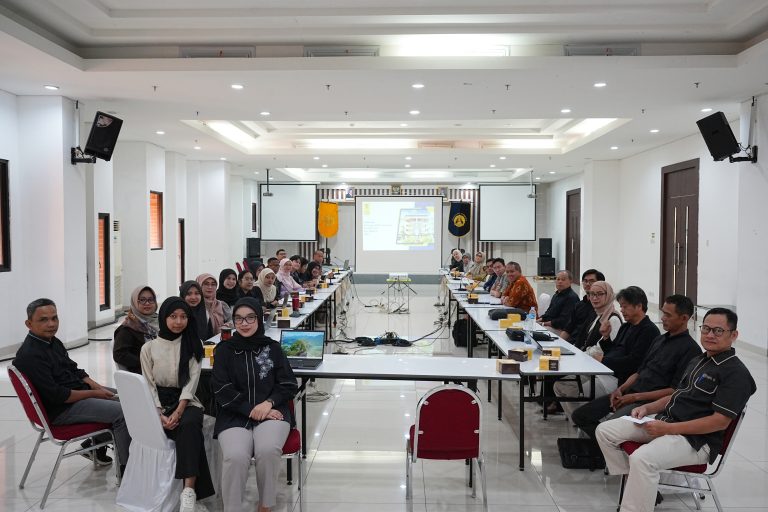
Therefore, to strengthen the ability of the community and its citizens in dealing with emergency situations, as well as carrying out independent evacuation during an earthquake, FMIPA UI through the Department of Geography held a training activity with the theme “Improving the Capacity of UI Geography Students in Facing the Threat of Earthquakes”, on Saturday, (28/09/2024) at Building H, Department of Geography, Depok Campus. The training which lasted for three hours was attended by around 80 participants.
Dr. Tito Latif Indra, M.Sc., Vice Dean for Resources, Ventures, and General Administration of FMIPA UI, as well as a lecturer in the Department of Geography FMIPA UI, in his speech said, “As part of FMIPA UI, we have a responsibility to ensure that our academic community is ready to face emergency situations. Through this training, we are committed to improving your knowledge and skills in disaster management and independent evacuation.”
Dr. Tito hopes that this training can provide deeper insight into disaster management and evacuation strategies, as well as encourage participants to become agents of change in their surrounding environment.
“The knowledge we gain here is not only for ourselves, but also to be shared with others in our community,” he added.

In addition, Nurul Sri Rahatiningtyas, M.Si., as a representative of the lecturers in charge of the course, provided an explanation regarding the updating of active fault lines on the 2017 earthquake map by the Ministry of Public Works and Public Housing, the National Earthquake Center (PuSGeN), and BRIN until 2024. According to her, this update is an important step to understand the geological dynamics of Indonesia, which is known as an earthquake-prone country.
From the update, said Nurul, there were an additional 55 active earthquake segments in Sumatra, 37 segments in Java, 48 segments in Sulawesi, 80 segments in Papua-Maluku, and 49 segments in Nusa Tenggara, which showed an increase in earthquake vulnerability throughout Indonesia.
“With a better understanding of earthquake parameters, we can now identify active faults more effectively. For example, in Java, the 2010 Earthquake Map recorded 6 active faults, while the 2017 Earthquake Map recorded 31 active faults, and it is estimated that there will be around 75 active faults in the 2024 Earthquake Map,” explaining the importance of updating geological data and earthquake risks to improve community preparedness for disasters.
He also emphasized that this information is not only useful for researchers and academics, but also for city planners, local governments, and the general public. He also invited all parties to collaborate in efforts to disseminate this information so that it can be widely accepted and used to create a safer environment for all citizens.
The materials presented in the training include disaster management, Digital Mutual Cooperation in dealing with earthquake disasters with PetaBencana.id, and disaster preparedness in the campus environment with direct practice and simulation.