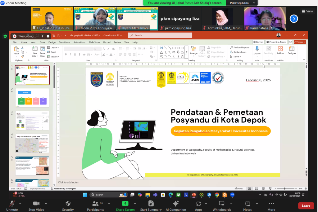
The Community Service (Pengmas) Team from the Department of Geography, Faculty of Mathematics and Natural Sciences (FMIPA), University of Indonesia (UI) consisting of Iqbal Putut Ash Shidiq, M.Sc., Ph.D. (lecturer and head of the Pengmas team), Dr. Tjiong Giok Pin, M.Si. (lecturer of the Participatory Mapping course), and Ramanatalia Parhusip, S.Si. (research assistant), held an online training aimed at improving understanding of spatial mapping and analysis. The training, which was held on Thursday (6/2/2025), was intended for medical personnel, health administration (adminkes) of health centers, and staff of the Depok City Health Office.
In this online training, the FMIPA UI Geography Community Service Team provided training to dozens of medical personnel and health administrators from various health centers in Depok City, regarding data collection based on geotag photos, as well as map creation using applications such as Google Photos, My Maps, and Story Maps. With refreshment course ini, diharapkan peserta dapat memperdalam pengetahuan dan keterampilan mereka dalam menganalisis data spasial untuk mendukung layanan kesehatan yang lebih baik.

Iqbal Putut Ash Shidiq, M.Sc., Ph.D., as the training facilitator and head of the Pengmas team, explained that this activity aims to ensure that participants not only understand the theory, but can also apply it in their daily work.
“This training provides practical guidance on how to update data using previously introduced applications,” said Iqbal.
The training also featured Ranamatalia Parhusip, S.Si., as an instructor who guided participants in implementing new techniques in spatial analysis. According to Ranamatalia, the participants showed high enthusiasm in participating in this training. Discussions and Q&A sessions were held to ensure participants’ understanding of the material presented.
“The participants showed quite high enthusiasm in participating in this training. We also held discussions and Q&A sessions to ensure that they truly understand the material presented and can implement new techniques in spatial analysis,” he said.

This activity is a continuation of the previous event, namely the handover of community service results (pengmas) in the form of a map of the distribution of ambulance service points in Depok City, and a map of the distribution of integrated health post locations in Tugu Village. The event was held at the Depok City Health Office on Friday (1/24/2025).
The mapping activity of the distribution of ambulance service points was funded by UI through the Directorate of Community Service and Empowerment (DPPM), which has now changed its name to the Directorate of Community Service and Social Innovation (DPIS). Meanwhile, the mapping activity of the distribution of posyandu locations in Tugu Village received funding support from the Research and Community Service (RPM) FMIPA UI unit, which has changed its name to Research and Community Service (PPM) FMIPA UI.
Both community service results were received directly by the Head of the Depok City Health Office, dr. Mary Liziawati. In her speech, dr. Mary expressed her appreciation for the contribution of the FMIPA UI Geography Community Service Team in improving the quality of health services in Depok City.
“The submitted maps are very useful in improving the distribution of ambulances and other health services. We hope this collaboration will continue,” said Dr. Mary.
As is refreshment course This, it is expected that medical personnel and health administrators in Depok City can become more proficient in managing spatial data for more effective planning and decision making. This will certainly help improve the responsiveness and quality of health services in Depok City.
The FMIPA UI Geography Community Service Team is committed to continuing to support the improvement of human resource capacity in the health sector through geospatial-based innovation.
This article has also been published on the channel okezone